Exploring the ocean floor


Activity description
In this activity, students are challenged to investigate topics related to the movement of tectonic plates, the age of rocks/sediments found on the ocean floor, and to discuss issues related to the sustainability of the planet.
Students use various technological tools such as Google Earth and GeoGebra to explore the topics mentioned. They engage in several group activities, including completing a guided worksheet and preparing for a role-playing debate based on the following problem-question: “Should the Portuguese government allow oil exploration off the national coast?”
The activity is divided into two complementary phases:
-
First phase – exploration of issues related to the ocean floor, tectonic plate movements, etc.;
-
Second phase – more connected to physics and chemistry, focusing on how humanity exploits the planet’s limited resources, specifically oil. This second phase is based on an activity developed by Tenreiro-Vieira and Vieira (2014), which presents an example of how to implement a role-playing strategy in the classroom.


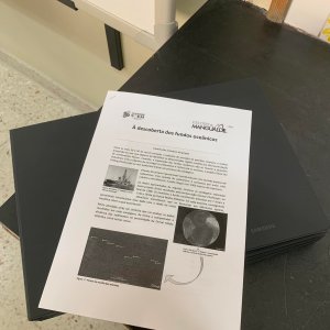
Student Guide
KMZ file: “Drillings on the Mid-Atlantic Ridge”
Spreadsheet on the relationship between the age and distance of sediments from the rift zone
Video of the debate broadcast on Prós e Contras (2018), titled “The Oil of Discord”
Identification sheets of the social actors for the debate session
Computers/tablets with Google Earth Pro, GeoGebra, and a spreadsheet application
Make available on the computers and tablets the various tools needed for the activity: GeoGebra file, KMZ file, and spreadsheet application properly prepared
Student profiles
Essential learnings
Please download the following files:
Activity guides
Activity Introduction
The activity is introduced by referring to the career context of geologists and other specialties related to ocean floor mapping, in this case focused on the collection of marine drilling samples, in order to understand the dynamics of sediments near the Mid-Atlantic Ridge. Students are reminded that the ocean floor is made up of magmatic rock resulting from the cooling of magma emerging from the rift, and it is explained that various sediments, which may include microfossils, are deposited on top of this rock.
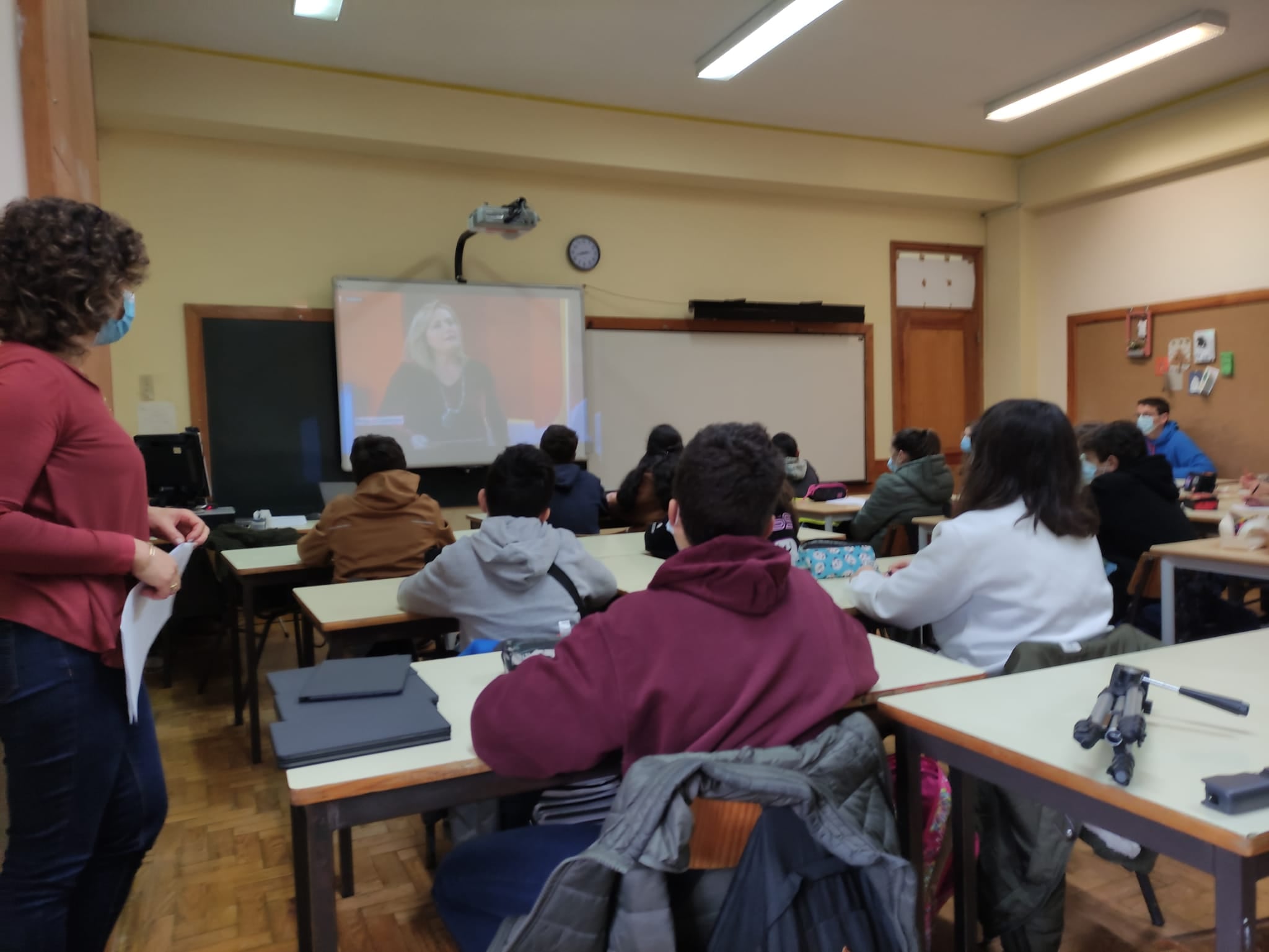
The student guide is distributed, and one student is asked to read the introductory context of the activity. The following image is then explored in a whole-class discussion:
Some guiding questions are presented for analyzing the image:
-
Give examples of human exploration of the ocean floor. What are the advantages and disadvantages?
-
What type of rock is most common on the ocean floor?
-
On top of this rock, sediments are deposited. Give examples of elements found in the sediments deposited on the ocean floor.
-
How do scientists calculate the age of rocks on the ocean floor?
-
In which drilling site would you expect to find the most recent rocks? Justify your answer.
-
Propose a hypothesis for why the rocks collected at drilling site 16 are more recent compared to those at site 14.
Activity Development
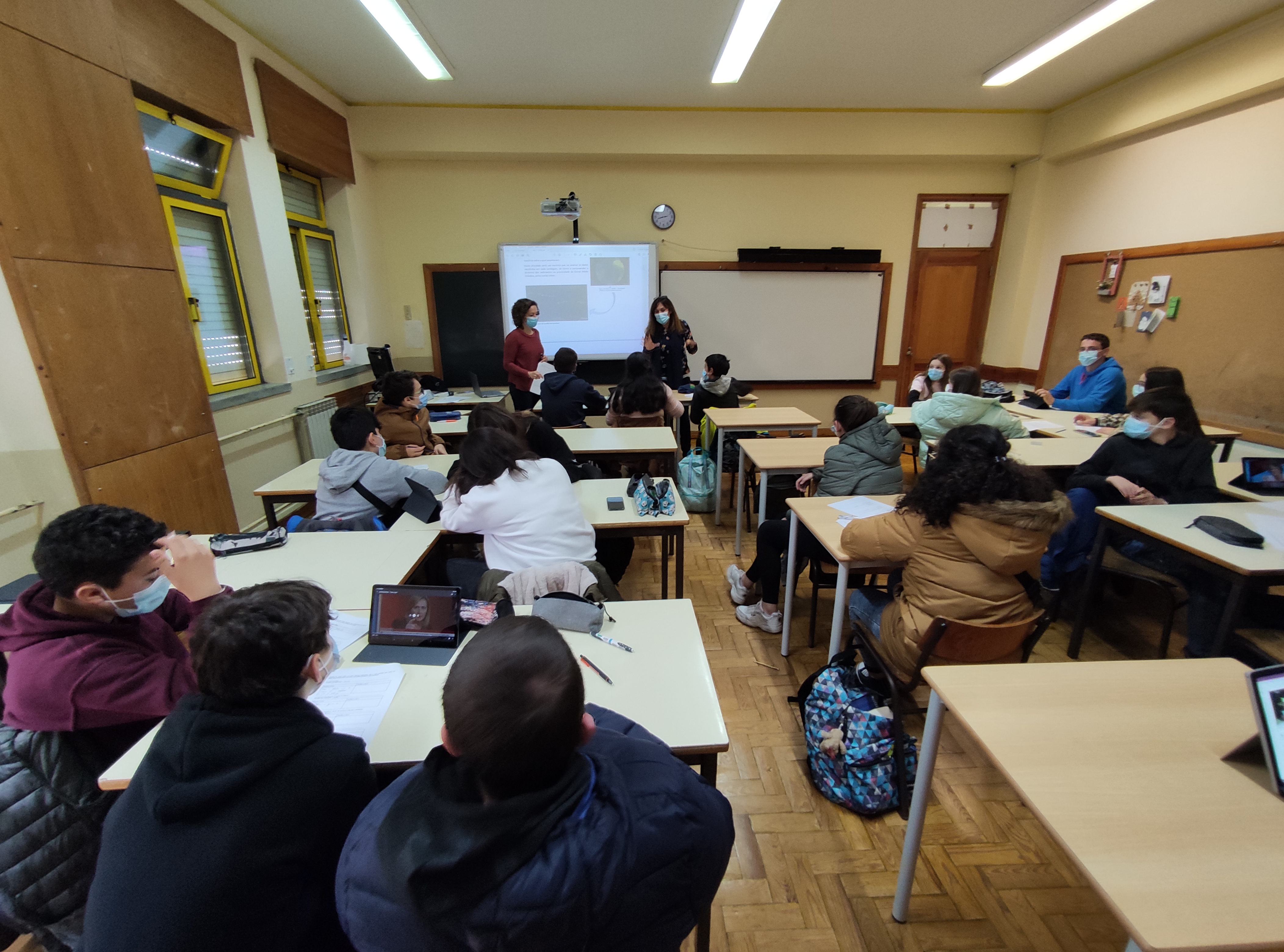
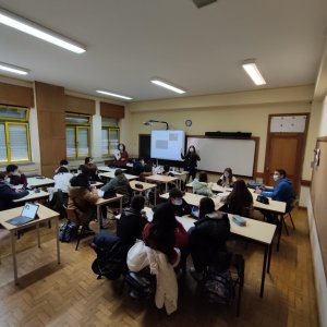
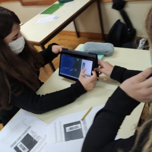
In the first part of the activity, the class is divided into groups of no more than four students, and they are asked to complete the various tasks proposed in the student guide.
With the collaboration of Natural Sciences and Mathematics teachers, support is provided for completing the different tasks. Below are examples of questions that can be posed for some of the tasks in the student guide to aid in reflection, analysis, and response evaluation.
For Task 1, questions such as the following can be asked:
-
Based on the data collected, is it possible to relate the age of the sediments to the distance from the Mid-Atlantic Ridge?

Students may have some difficulty drawing conclusions about this relationship directly from the table. As a support, it is suggested that they use the table data to create a graph.
In Task 2, the teacher highlights that although the regression line does not represent a perfectly linear affine function, for the sake of simplifying calculations, it is considered that the line passes through the origin of the coordinate system. A line passing through the point with coordinates (40, 800) may be drawn to help with this simplification. Questions such as the following may be posed:
-
The equation of the line we drew is y = 20x. What information does the constant k = 20 give us?
-
Does this line represent a function of direct proportionality? Justify.
-
What is the meaning of the proportionality constant? (Note that y/x = 20 km/Ma)
Students may also use the following GeoGebra representation for data verification and exploration:
https://www.geogebra.org/classic/msqtfuwz

(x-axis – age of sediments in millions of years; y-axis – distance in km from the sediments to the Mid-Atlantic Ridge)
In Task 10, questions such as the following may be asked:
-
Since the islands of Flores and Corvo are located west of the rift, what do you predict will happen to their distance compared to the other Azores islands located east of the rift?
-
What can you conclude about the movement of Faial Island in relation to the rift?
In Task 11, questions like these may be posed:
-
This energy powers a mechanism responsible for the expansion of the ocean floor. What is the name of this mechanism?
-
In which layer of the Earth’s interior does this mechanism occur?
In the second part of the activity, which involves role-playing, students are provided with documents (real or fictional) containing evidence to support them in constructing arguments.
They are also given recording grids to help organize and process information in preparation for defending their group’s position during the debate. Roles are then assigned to the students, and the debate is carried out.
After completing the tasks in Part I of the student guide, the following guiding question is introduced:
Why does humanity explore the ocean floor?
This exploration is connected to the planet’s sustainability and the use of limited resources. As preparation for the role-play session to take place in the third session of this second phase, students are asked to read the Jornal de Negócios article from June 1, 2018, “Costa diz que se houver exploração de petróleo em Portugal terá de haver estudo prévio”.
The news article is explored by posing questions about its subject matter, the entities and social actors involved, the reasons given for the exploration, among other aspects.
After exploring the news article, an excerpt from the RTP 1 program Prós e Contras, aired on September 10, 2018, titled “O Petróleo da Discórdia”, is presented so that students can engage with the different viewpoints of the participants.
Some questions are presented to initiate reflection:
-
Should the country authorize oil prospecting off the Portuguese coast?
-
What are the advantages and disadvantages or risks of oil extraction?
-
How does a scenario of oil exploration off the Portuguese coast align with climate change mitigation?
Students are then asked to answer questions from Part II of the student worksheet, from point 2 to point 3.
The students begin the role-playing activity around the socio-scientific question: “Should the Portuguese government support oil prospecting in Portuguese waters?”
The activity begins with the assignment of roles (5 groups — number of social actors needed for the role-play) and the distribution of identification labels for each group to place at their stations:
-
Economists
-
Environmentalists
-
Residents near the Aljezur coast
-
Energy experts
-
Consortium of oil companies
Groups are asked to respond to point 4 of the worksheet in order to prepare for their participation in the debate.
The teacher initiates the debate by introducing the various groups present, as well as the debate format.
Each group is asked to have a representative present their position regarding the central question “Should the Portuguese government support oil prospecting in Portuguese waters?” and the reasons behind it. As different arguments are presented, students are encouraged to take notes. The role-play is guided by prompting each group to verbally express relevant evidence and arguments.
Conclusion of the activity
After the role-play on the central question, students are asked to work in groups to describe a set of measures or actions to resolve the conflict, including concrete proposals to be sent to the Portuguese government.
Essential learnings
Evidence / Student action
- Caracterizar a morfologia dos fundos oceânicos, relacionando a idade […] das rochas que os constituem com a distância ao eixo da dorsal médio-oceânica.
- Questionamento oral durante a introdução da atividade; Resolução das tarefas 4 e 7 do Guião do Aluno.
- Relacionar a expansão e a destruição dos fundos oceânicos com a Teoria da Tectónica de Placas (limites entre placas) e com a constância do volume e da massa da Terra.
- Questionamento oral durante a introdução da atividade; Discussão acerca das resoluções das tarefas 8, 10 e 11.
- Distinguir fontes de energia renováveis de não renováveis e argumentar sobre as vantagens e desvantagens da sua utilização e as respetivas consequências na sustentabilidade da Terra, numa perspetiva interdisciplinar.
- Argumentos e contra-argumentos a usar durante o desempenho de papéis.
- Representar e interpretar graficamente uma função linear e relacionar a representação gráfica com a algébrica e reciprocamente;
- Discussão sobre a resolução da tarefa 2 do Guião do Aluno.
- Resolver problemas utilizando equações e funções, em contextos matemáticos e não matemáticos, concebendo e aplicando estratégias para a sua resolução, incluindo a utilização de tecnologia, e avaliando a plausibilidade dos resultados;
- Resolução das tarefas 7 à 10 do Guião do Aluno.
- Exprimir, oralmente e por escrito, ideias matemáticas, com precisão e rigor, para explicar e justificar raciocínios, procedimentos e conclusões, recorrendo ao vocabulário e linguagem próprios da matemática (convenções, notações, terminologia e simbologia).
- Discussão, em grande grupo, acerca do afastamento da ilha das Flores da zona da rifte em 10 Ma.
Deep Earth Academy. (2018). An expedition to the sea floor. Acedido em https://joidesresolution.org/activities/an-expedition-to-the-seafloor/ em 30 de junho de 2022
Jornal de Negócios. (2018). Costa diz que se houver exploração de petróleo em Portugal terá de haver estudo prévio. Acedido em https://www.jornaldenegocios.pt/empresas/energia/detalhe/costa-diz-que-se-houver-exploracao-de-petroleo-em-portugal-tera-de-haver-estudo-previo em 30 de junho de 2022
Prós e Contras. (2018). O petróleo da discórdia. Acedido em https://www.rtp.pt/play/p4234/e364171/pros-e-contras em 30 de junho de 2022
Tenreiro-Vieira, C., & Vieira, R. (2014). Construindo práticas didático-pedagógicas promotoras da literacia científica e do pensamento crítico. Madrid: Organização dos Estados Ibero-Americanos.
Between the 1930s and 1950s, the oil extraction industry began conducting offshore prospecting to determine whether certain regions contained fossil fuel deposits. However, the exploration of the ocean floor goes beyond industrial concerns. Aimed at investigating the sediments and rocks beneath the oceans, the Deep Sea Drilling Project was launched to carry out drilling operations.
The ocean floor is generally made up of a thick layer of sediments. This layer consists of sand, silt, limestone, and microfossils and can reach up to 2,000 meters in thickness.
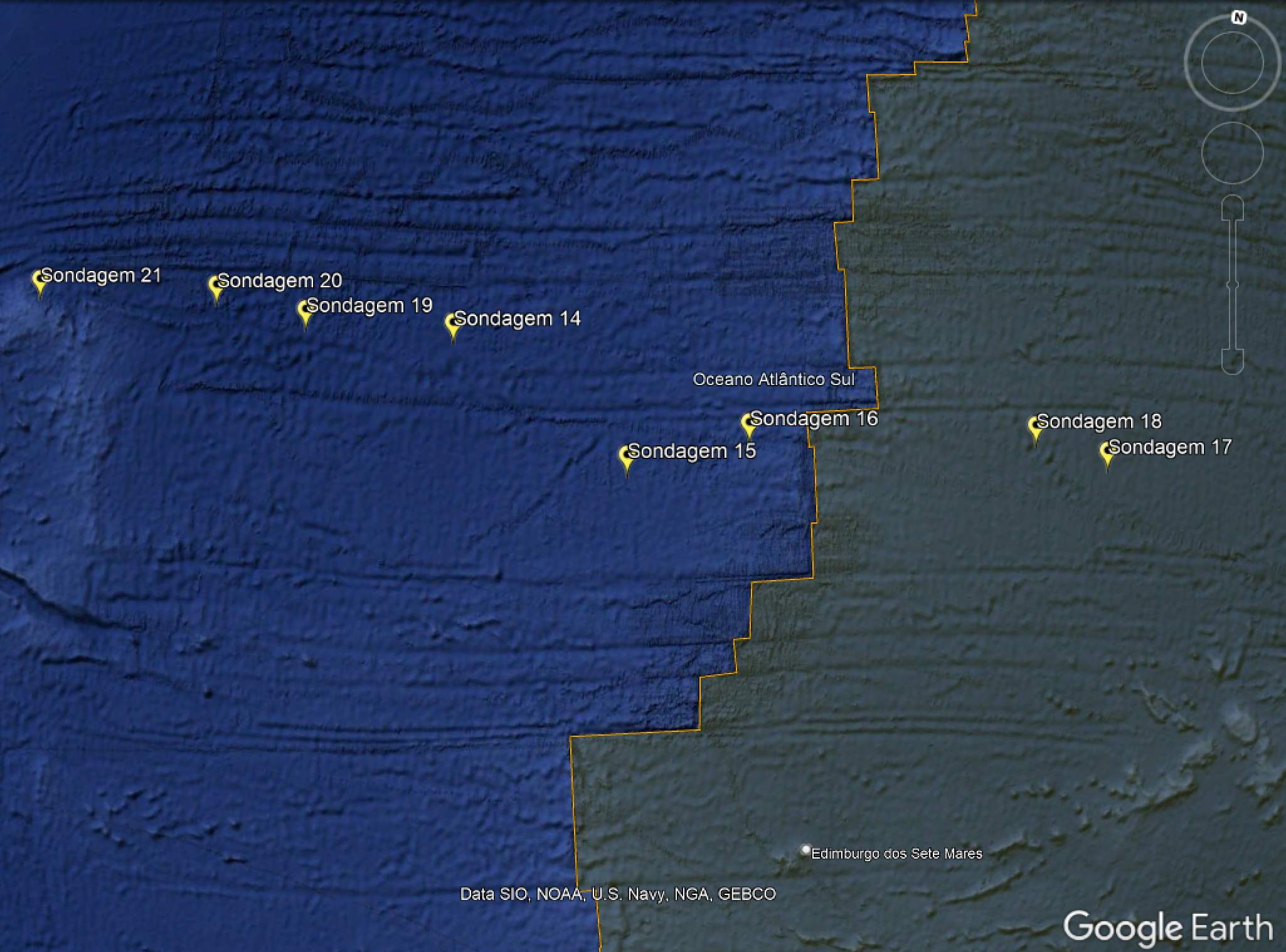
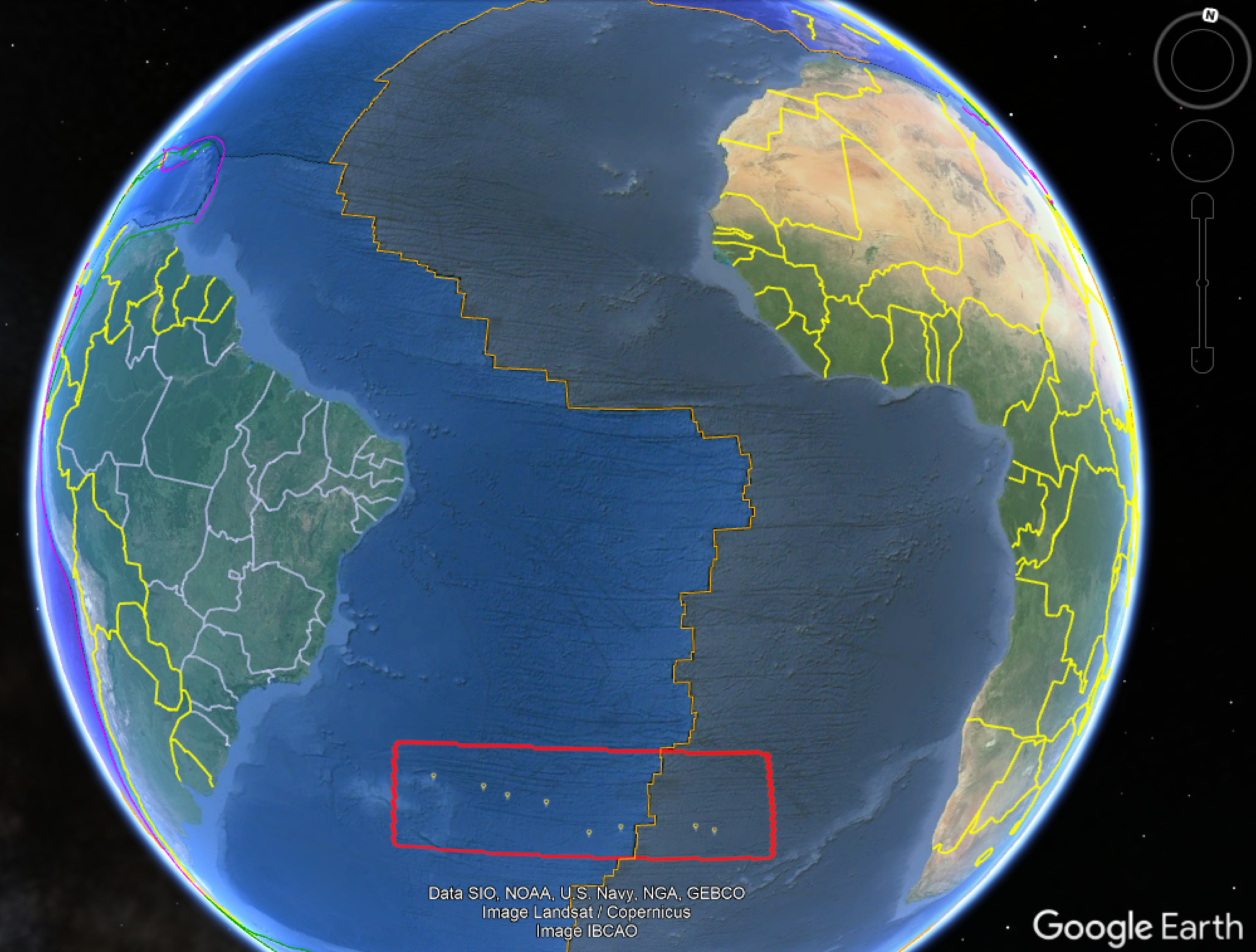
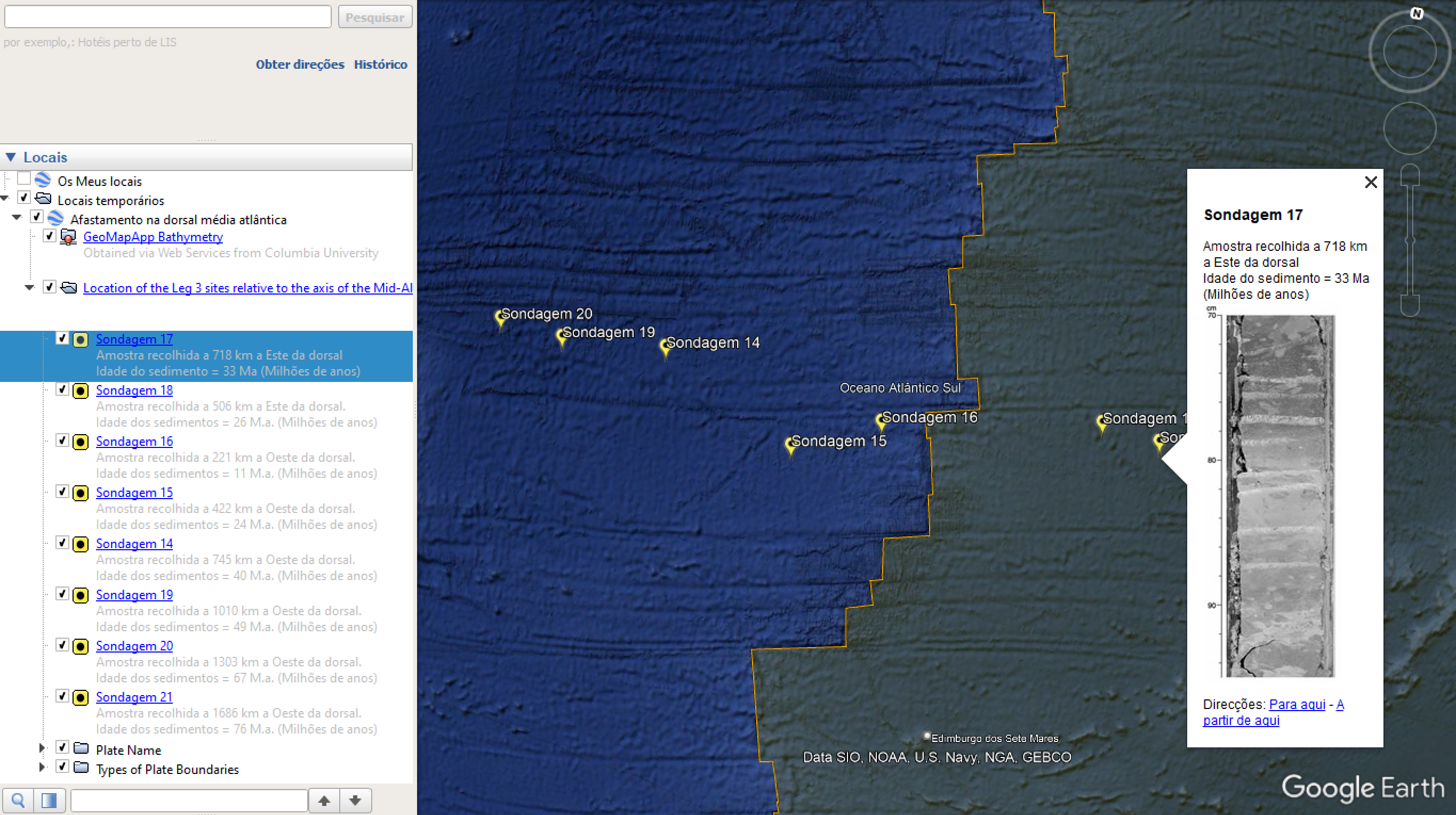
The following data, related to the drillings carried out by this project, were collected by the Glomar Challenger vessel at the end of 1968. Scientists on board collected samples from seven locations east and west of the Mid-Atlantic Ridge. In each sample, they were able to identify microfossils formed in different geological periods, allowing them to correlate this information with the age of the underlying basaltic rock.

In this activity, you will take on the role of a scientist who will analyze the data collected from each drilling site in order to understand the sediment dynamics near the Mid-Atlantic Ridge, among other things.

Part 1
Task 1 – Recording drilling data
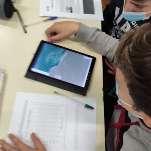
After opening the file “Sondagens na dorsal média atlântica.kmz” in Google Earth, click on each drilling site in the menu on the left and record the corresponding data in the following table:
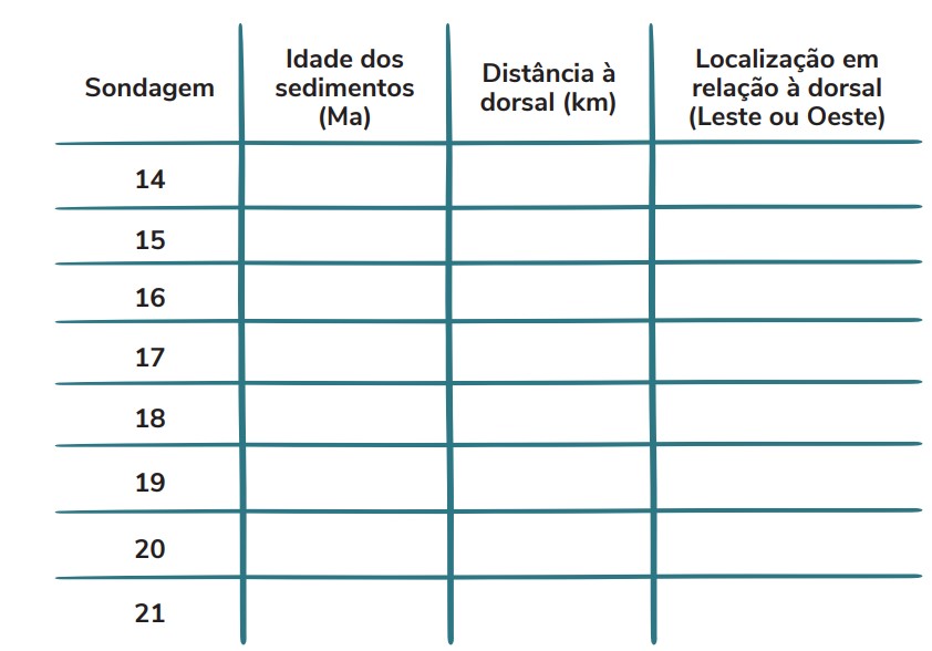
Task 2 – Graphical representation of data
Plot the various drillings as labeled points (Sediment age; Distance to the ridge) on the graph below. Then, draw a trend line that passes through as many points as possible (use a ruler).

Task 3 – Write a sentence explaining the meaning of the line obtained in the previous task’s graph.
Task 4 – Relate the age of the samples collected in the drillings to the distance of the drilling sites from the ridge, both to the East and West, explaining based on scientific evidence and known facts.
Task 5 – Identify the ocean from which the sediment samples were collected.
Task 6 – Identify the geological structure located between drilling sites 16 and 18 (see figure 3).
Task 7 – Calculate the seafloor spreading rate for each drilling site, filling in the table below

Task 8 – Calculate the average rate of seafloor spreading in km/Ma (kilometers per million years) based on the data in Table 2.
Task 9 – Convert the average seafloor spreading rate into centimeters per year (cm/year). How do you compare this rate to the growth rate of fingernails, which is about 3.6 cm/year?
Task 10 – Considering the average spreading rate you calculated in Task 8, what distance will Flores Island “travel” in 10 Ma

Task 11 – Propose a source of energy necessary for seafloor spreading
Part II
This Part II has been adapted from Tenreiro-Vieira and Vieira (2014, pp. 45–47), with the examples of questions presented by the authors either removed or adapted.
Point 1. Socioscientific Situation
“The Prime Minister said today [2018], in the Algarve, that if oil is found off the Algarve coast and a decision is made to move forward with hydrocarbon exploration, an environmental impact study must be carried out beforehand. […] António Costa, speaking to journalists in Loulé during a Children’s Day celebration event, warned that although the world is moving more and more toward decarbonization of the economy and renewable energies, we will still be ‘for many, many years’ dependent on oil. […]”
“…The country must know what resources it has in order to decide what to do with them, but the decision was very clear: if exploration is to take place, there must be an environmental impact study,” he stated.
Socioscientific question:
In light of the situation presented, should the Portuguese State support or oppose oil prospecting in Portuguese maritime territory?
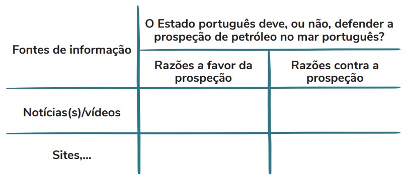
Point 2 – Fill in the following table, using the information sources mentioned within it.
Point 3. For each of the following stakeholders, say what you think each would support or defend regarding the presented problem-question.
3.1 Economists
-
Position they defend:
-
Reasons against:
-
Reasons in favor:
3.2 Residents near the coast of Aljezur
-
Position they defend:
-
Reasons against:
-
Reasons in favor:
3.3 Consortium – Group of oil companies: Center for Natural Resources and Environment
-
Position they defend:
-
Reasons against:
-
Reasons in favor:
3.4 Environmentalists
-
Position they defend:
-
Reasons against:
-
Reasons in favor:
3.5 Energy Experts
-
Position they defend:
-
Reasons against:
-
Reasons in favor:
Point 4. Fill in each column presented below, using researched information whenever necessary

Point 5. Debate/Role-play
Play the role that was assigned to you, presenting the reasons identified during the debate with the whole class regarding the problem-question:
“Should the Portuguese State support oil prospecting in the Portuguese sea or not?”
Point 6. Intervention measures
After the role-play based on the problem-question, describe, as a group, a set of measures or actions aimed at resolving the conflict and ensuring the population’s quality of life and well-being. This text will be sent to the Portuguese Government to contribute with ideas and suggestions for a situation that concerns everyone.