


Image


In this activity, students explore satellite images of the planet using Google Earth, taking into account different features such as continents, countries, oceans, mountains, and rivers. Students are challenged to solve mathematical problems related to the escape of two sisters from the war in Ukraine.
Laptops
Computer mice
Guide for placing “markers” and images in Google Earth
Drawing materials
Google Earth installed on the computers
Folder on the desktop with images of flags, rivers, mountains
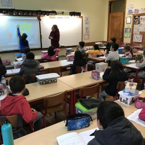
Activity Introduction
An image related to the continents is projected, and questions such as the following are posed:
What does the projected image represent?
Which continents can you identify?
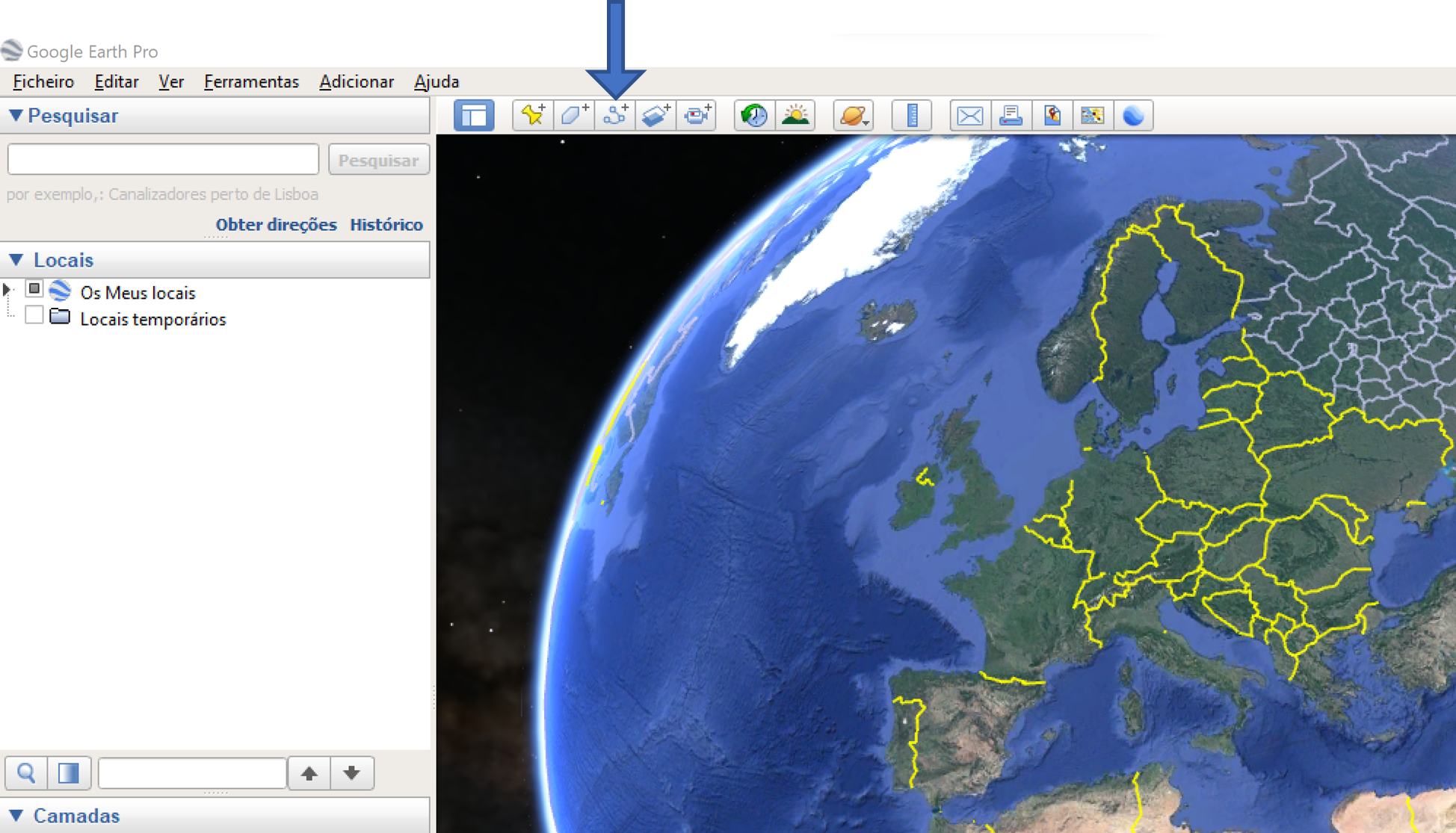
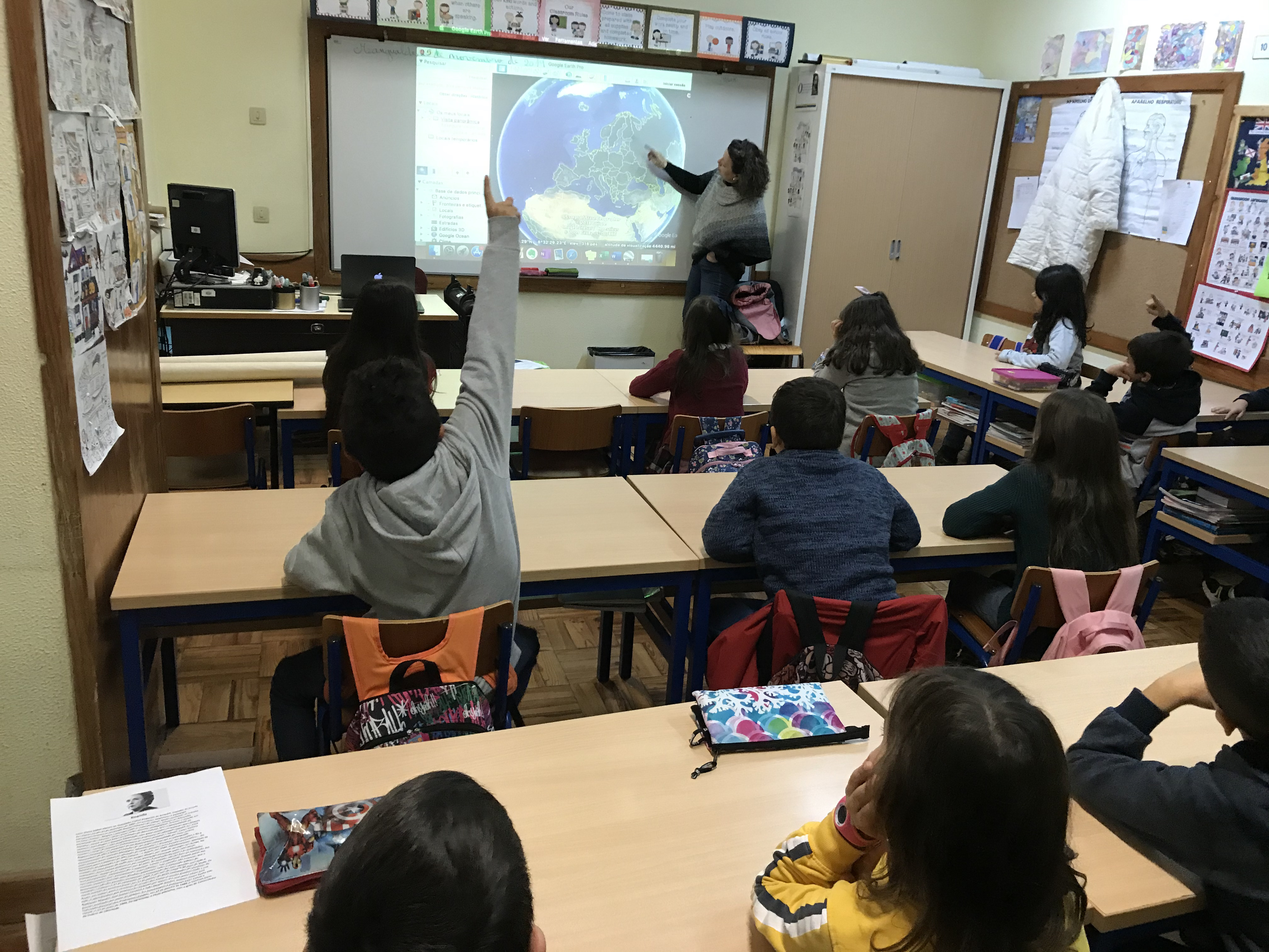
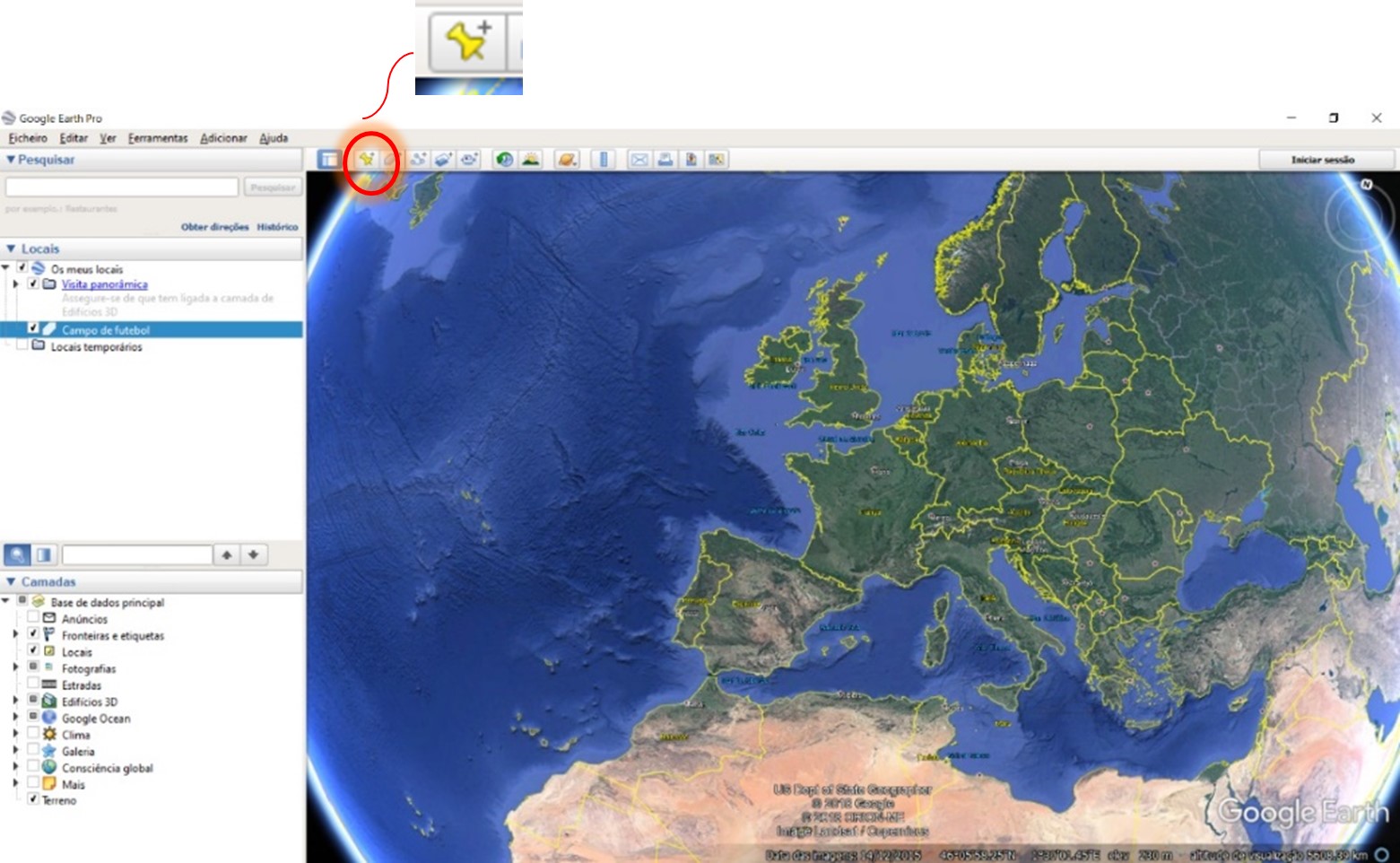
Using Google Earth, the European continent is then projected, and several of its countries are referenced. A polygon is drawn in the application to outline the European continent, representing both its land and maritime borders (click the indicated button in the image to perform the task).
Students are asked whether they have ever visited a European country.
Why did they leave Portugal? Was it for holidays, sightseeing, visiting relatives…?
Do they have relatives in any European country? Which one(s)?
The names of the countries mentioned by the students are written on the board so they can be later researched using Google Earth.
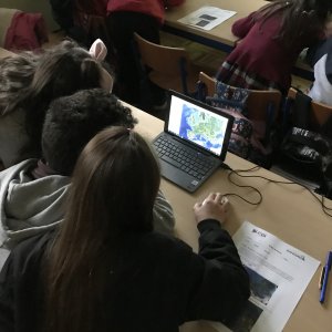
Students are divided into groups of three, and each group is given a laptop with a computer mouse.
Using the Google Earth application, the teacher demonstrates how to search for locations using the term “Mangualde”.
Students are asked to launch Google Earth on their computers and search for their local area.
They are then asked to search for the countries previously mentioned and listed on the board. It is suggested that they use Google Street View to explore, for example, the streets and buildings of a capital city from one of the mentioned countries.
The flags of six countries are presented (Portugal, Spain, France, Italy, Germany, and England), and students are asked to identify the country each flag belongs to.
Next, students are informed that it is possible to insert placemarks in Google Earth and associate images (e.g., flags) with those placemarks. The teacher demonstrates this using the classroom computer and provides a step-by-step guide (Student Guide – Part I).
Students are then instructed to access a folder on their desktop containing images of country flags. They are asked to insert placemarks in Google Earth for the mentioned countries and to associate each placemark with the corresponding flag image.

In the mentioned folder, there are images of mountain ranges (Serra da Estrela and Serra da Freita), rivers (Douro, Tejo, and Dão), forests (Buçaco and Gerês), and deserts (Tabernas, Spain; Oltenian Sahara, Romania). Students are asked to insert markers with the images in their respective locations. The students are then questioned if they know other rivers, mountains, etc., and some answers are recorded on the board that the class can use to search for images (for example, on Wikimedia Commons, a collection of freely usable images), save them to the desktop, and insert them as markers in their respective locations.
Activity Conclusion
The students present their markers on Google Earth to the whole class, as well as the results they obtained from solving the mathematical problem.
Mvs.gov.ua. 2022). Ukrainian refugees from 2022, crossing into Poland. Acedido em https://commons.wikimedia.org/wiki/File:Ukrainian_refugees_from_2022,_crossing_into_Poland.jpg em 30 de junho de 2022
National Geographic. (2022). Refugiados ucranianos partilham as suas histórias angustiantes. Acedido em https://www.natgeo.pt/historia/2022/03/refugiados-ucranianos-partilham-as-suas-historias-angustiantes em 30 de junho de 2022
Operational Data Portal. (2022). Ukraine refugee situation. Acedido em https://data.unhcr.org/en/situations/ukraine em 30 de junho de 2022
Parlamento Europeu. (2022). A resposta da União Europeia à crise de refugiados da Ucrânia. Acedido em https://www.europarl.europa.eu/news/pt/headlines/world/20220324STO26151/a-resposta- da-ue-a-crise-de-refugiados-da-ucrania em 30 de junho de 2022
Part I – Flags and Google Earth
The next task consists of placing markers with country flags on Google Earth.
Carefully observe the flags found inside the folder named “Flags” located on your computer’s desktop, and follow the instructions below with the teacher’s help.
Launch the Google Earth application.
Click on the yellow “marker” icon.
Use the mouse to drag the marker to the desired country and enter its name.
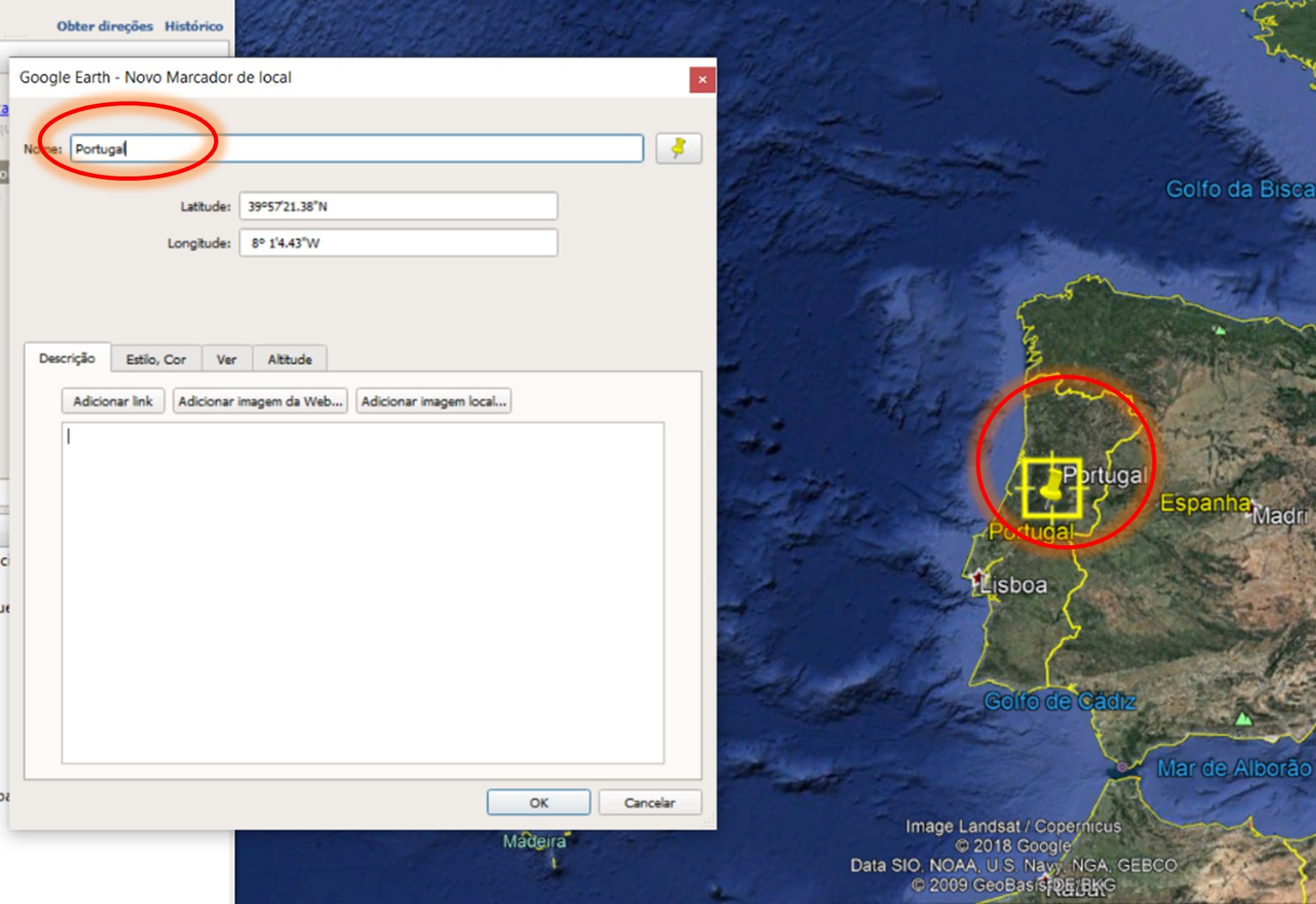
Add an image of the flag to the marker – Search for and select the desired flag inside the “Flags” folder located on the desktop.

Example of the flag of Portugal.

6. Repeat the same procedure for the remaining flags found inside the folder.
Part II – Refugees from Ukraine
Irina and Sattennik are sisters. They live in Ukraine and wish to migrate to a European country to escape the war.
Irina prefers to live in a northern European country, with lots of snow to skate and play. Sattennik prefers southern European countries, with golden sandy beaches and warmer weather.
They looked at the map of Europe and selected the countries where they would like to live.
Irina selected four countries in the North, and Sattennik selected two countries in the South.
1.1 Using Google Earth, identify the countries each sister might have chosen. Record the names of these countries in the following table.
| Irina | Sattenik |
2. Imagine that the sisters move to one of the countries Sattennik selected.
2.1 Determine the distance between a specific city in Ukraine and a specific city in the destination country using Google Maps.
2.2 Assuming the sisters traveled by car between these cities, and the car consumes on average 7 liters of gasoline per 100 km, calculate the amount of gasoline in liters they need to store for the entire trip.
Annex
The European Union’s Response to the Ukrainian Refugee Crisis
The Russian invasion of Ukraine has forced millions of people to flee their homes. Learn what the EU is doing to help them and manage its external borders.
The invasion of Ukraine by Russia in February 2022 created one of the largest humanitarian crises in recent European history, with the ongoing war causing an increasing number of casualties, destruction, and displacements both inside and outside Ukraine’s borders.
The civilian population of Ukraine is being subjected to bombings and violence, with millions of people forced to move either within the country or to neighboring states—mainly Poland, but also Romania, Slovakia, Hungary, and Moldova. It is estimated that 90% of these people are women and children, who face a higher risk of violence and abuse, including human trafficking, smuggling, and illegal adoption.
Text adapted from the European Parliament (2022). The European Union’s response to the Ukrainian refugee crisis. Accessed at https://www.europarl.europa.eu/news/en/headlines/world/20220324STO26151/the-eu-response-to-the-ukrainian-refugee-crisis on June 6, 2022.
